Slight shower entering Colorado.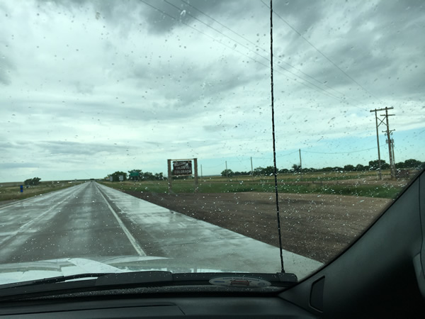
Some of the road to Casper, WY.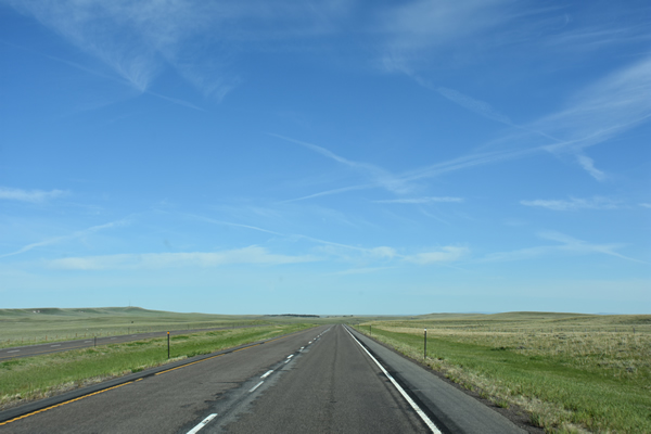
Medicine Bow Museum, Medicie Bow, WY.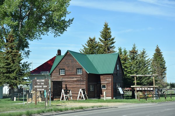
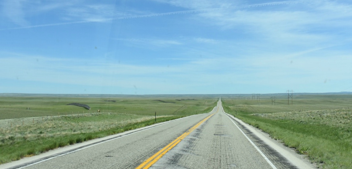
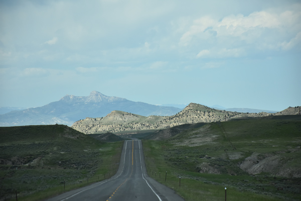
Some of the road after Casper, WY.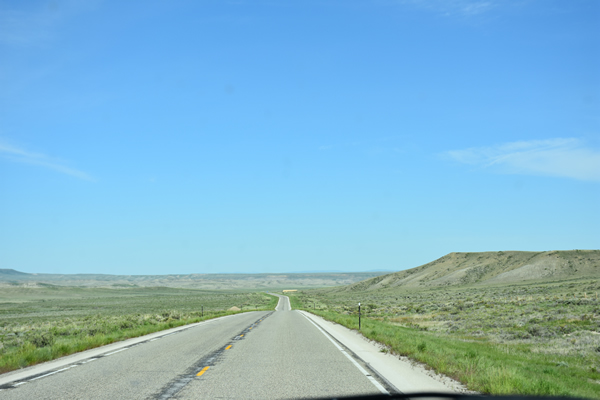
Big Horn River north of Shoshoni, WY.
As we drove out of the north end of Shoshoni, the road hugs the Big Horn River and you're now in the river's valley. There are some interesting rock formations and points where the rapids are verging on spectacular. Minnesela, where you cross to the west side of the river, is the only town until you come to Thermopolis, who's claim to fame are the hot springs that burble in the state park. We didn't stop. We did turn left onto WY-120 to head to our end point of the day. We skipped the longer route of Red Lane, Lucerne, Kirby (home to Wyoming Whiskey), Winchester, Worland, Washakie Ten (fun name - Washakie was a Shoshoni chieftain), Mandersen, Basin, and Greybull. Our destination was Cody, Wyoming, where we would bunk down for the night at Ivy's Best Western. And so the smaller places of Meeteetse, where you cross the Greybull River, and Dry Creek which isn't actually a place at all as far as we could tell, are the only notables until the road t's at US-14 at the east end of Cody.
Why Cody? It was the most logical place to start our foray into the National Parks. Early plans for the trip took us farther north after getting to Chicago, taking I-90 up and then west ending us up in Billings, Montana. From Billings, the road into Yellowstone would have been an interesting drive along US-212 (the Northeast Entrance Rd.) to Tower Butte, but the waypoints between Toronto and Billings weren't optimal. Add that to the added driving time over the first 2 days meant we didn't think it was worth the effort to see the very northern end of Yellowstone, so Cody is where we pointed the hood. The "biggest" thing to do in Cody is to visit the Buffalo Bill Center of the West. We didn't. It was very full, we were pretty pooped, and we didn't feel like spending the $40 to get in. We did go to the grocery store and pick up supplies for a picnic the next day in the park, as well as snacks for the room. We also got some wine and beer from the purveyor of spirits next door to the grocery store. The woman running the place when we stopped in was in the midst of changing all the pricing of the inventory as the result of a new (upward) state taxation percentage; she wasn't too happy about it but more than happy to tell us all about it. It's always a risk being the only customers in a store. If we could have used the tap feature on your credit card we'd have gotten out sooner. We had a little lookabout town to see what was on the main street (Sheridan Ave.) and then went back to the hotel to have a little cocktail hour. After a couple of drinks and some nibbles I fell asleep, so we didn't go out to Irma's in the old Buffalo Bill Hotel. In fact I slept until the next morning - the hours behind the wheel had caught up.
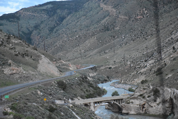
Monday morning, day 4. Up early, 4am. After checking out at 5am and topping up on Best Western coffee, filling up the tank at the Mobil on Yellowstone Ave., we aimed the truck west along the North Fork Hwy (aka US-14, US-16 & US-20) past the Bill Cody Ranch and Pahaska Teepee (where the North Fork of the Shoshoni River and the highway part company). The Cody Mountain Tunnel was darted through arriving and as the sun started to come up just as we approached Wapiti there was only a few miles left until we arrived at the east entrance to Yellowstone an hour after leaving Cody.
The Ranger on duty was terrifically nice, as were the two moose poking around for some breakfast just feet away - a true sign we were about to see some amazing sights. Armed with maps and park info, our drive took us winding through the valley, around Avalanche Peak, up higher to hook around where the road crosses Cub Creek and then back down along the eastern shore of Yellowstone Lake. Bison could be seen in the flat around Mary Bay and perhaps signaled we should stop at the Fishing Bridge Visitor Center for a picnic breakfast. The Visitor Center itself was closed, but the facilities were well heated; advantage of their existence was taken. It was certainly cool that morning, our northern location augmented by the elevation meant there was a real chill in the air, but as we ate the sun mustered itself above the peaks to warm us up. The east entrance road T's just west of where we ate, so we turned north toward Canyon Village. Moments after that turn, just upstream from LeHardy's Rapids at N44.609259 E-110.399487, we pulled off to see a brown bear across the Yellowstone River catching her own breakfast. Sighting of moose, bear and bison all in an hour. We kept our eyes open for more wildlife as we got to the Grand Canyon of Yellowstone.

After walking a few of the trails and taking in the views of the gorge, we took Norris Canyon Road west from Canyon Village over to the Grand Loop Road (US-89) and before turning south towards Madison Junction, stopped to wander the trails at the Norris Geyser Basin. We stuck to the Porcelain Basin and admired the sulphur smells and green waters of Congress Pool and the Whale's Mouth. The steep climb back up to the little museum was, well, surprisingly steep. Pause here just to talk about all the geysers and pools in the caldera of Yellowstone - they are something, and I'm sure would have been an absolute wonder to the aboriginal peoples given they had no science to explain what they were seeing; it's almost too bad that you're able to walk through these areas along the wooden walkways because the natural luster of these areas seems diminished somehow. Back in the truck we felt we'd seen enough mini-geysers and chemical pools, so we headed south to see if by chance Old Faithful's schedule was in any way synchronized to ours. It was around 11am now, and there was also the matter of food and a washroom to consider. On the way, another buffalo decided to pose for us.

From Madison Junction, we turned left to continue south to the Yellowstone Lodge. Now on US-191 and skirting the Firehole River, the scenery in the area is rolling hills dotted with trees. On approach to Old Faithful ("OF") we stopped in the parking lot of the Old Faithful Inn (not to be confused with the Old Faithful Lodge of course) and Naomi went in to find out when the next burst of hot water might be expected. As luck would have it, the geyser was due in 5 minutes with a margin of error of 15 minutes. Old Faithful apparently has become less so over the years. Bathroom break complete we left the truck where it was and walked a short way east across the parking lot to the edge of a service road and stood with an unobstructed view - there were multiple hundreds of people over at the "proper" viewing area between the Inn and the Lodge. We waited. OF would hiss and burble every so often. We waited. We waited the full 20 minutes and then OF decided the pressure of the magma below heating a pool of ground water was too much (it had nothing to do with our intense staring) and we were witness to a 60 foot geyser of steam and boiling water. Three minutes later it was over. People clapped. I'm not sure Mother Nature needs or even wants our applause, so I found the clapping odd. We wandered back to the truck and got back on the road heading to West Thumb.
West Thumb is a bay in Yellowstone Lake. From there, heading south, the road takes you along the east shore of Lewis Lake (named for Merriweather Lewis, commander of the Lewis & Clark expedition that lasted from 1804-1806). Another half hour saw us arrive along the east shore of Jackson Lake, enlarged from its original footprint by the Jackson Lake Dam in 1908. Across the lake the Grand Teton mountains come into better view now that we had left Yellowstone. Once we'd passed the Jackson Lake Lodge, we kept right onto Teton Park Road to head towards Jenny Lake. On the more east-west portion of the road underneath Jackson Lake's Spalding Bay, you're driving directly at Rockchuck Point and Mount Saint John.

We pulled off at the Mount Moran Turnout to take some pictures of the Tetons, before heading onto Jenny Lake Road. Mount Moran is off to the northwest when at the turnout, with Mount Horn just in front to the south - you are essentially looking over Spalding Bay and across Leigh Lake (you can't see that from here though) and the view of the range here is definitely worth the stop. In the picture below, Mount Moran is the extreme right, Rockchuck Point is center and Mount Saint John is middle left. A little further along we turned west some more on Jenny Lake Road, to see actually if it was going to live up to the hype. We tried to park near the Lodge, and then again not so near the lodge, but now it was early afternoon and there was no room anywhere. Even the official turnoff for the Overlook was a non-starter. We kept driving along the road and found a spot to pull off the road (a bit sketchy, the truck was leaning quite a lot to the right). If the speed limit had been anything higher than 15mph I don't think we would have stopped. A little scamper through the woods found the trail that followed the shore and we took some pictures of the Tetons across the water. Hmph. It was a lake, the water was clear, but it was short of spectacular. That was the end of what needed seeing, so we got back on the Teton park Road which took us to US-191 and we drove south into Jackson. The town is Jackson. The valley is Jackson Hole. Either will work with Google Maps. We drove into the main part of town which is centered on a town square. A right turn at the light onto West Broadway Avenue, you curve around to the left and eventually find Scott Lane where The Lodge at Jackson Hole awaited us. We were here for two nights to have a good explore and a rest from the road. The hotel was nothing special, the photographer who took the pictures for the hotel website hopefully was paid a lot of money, because he certainly earned it. It wasn't bad, it just wasn't "as advertised". After a shower and a drink, we dressed for dinner and headed back into the center of town to dine at Trio Bistro. OMG. Dinner was excellent. Best Caeser salad I've had in forever. And the steak was perfectly cooked, cut like butter and was so incredibly full of flavour. We were nearly joined by a group of Europeans (couldn't quite decipher the language, but it seemed Swedish) but after they sat down and couldn't understand the specials, they left. Shortly thereafter, a group of three sat down beside us - a thirty-something woman and her parents. Mom and daughter were dressed exactly the same, except the v-neck sweaters were yellow (daughter) and bright orange (Mom). They talked nonsense, mostly about the daughter's pending nuptials, and how much money the fiancé made, and where were they going to buy a house. There was a lot of internal mockery happening of some kind, some not; thankfully we were done and could escape. After dinner, we had a short walk around the square, but we were bushed so found the truck and went back to the hotel for a good night's sleep.
Tuesday morning, day 5. Up early, 5am. What to do... what to do? Breakfast. The only (sorta) good thing about the hotel was that it had a fulsome buffet breakfast. The dining room was full of folks best described as a-typical bus tour people; they were super polite, mostly 60+, and they all showed up at the same time. Now we never did see the bus they were taking from somewhere to somewhere so we don't know exactly where they were headed. My favourite was Mabel (they all wore stick-on "Hello, my name is:" tags). Mabel was a dear, shrunken old soul who seemed not to take crap from anyone but would knit you a sweater in a day if you asked her to. Sweet and salty if you can picture her. We ate (I ate a lot) and then were all set to head out and explore, except, well we didn't have anywhere in particular to go today. Nothing in Jackson was going to be open until 10, or even 11am, so that left a bit of an activity vacuum. When in doubt: drive.
Turning south on US-191 from the hotel, we drove through South Park, crossed the Snake River so it was now on the east side of the truck and then entered Coles Canyon, where we crossed the Snake again as the road swung more southwesterly. Crossing the Horse Creek, we arrived in Holback Canyon where the Holback River joins the Snake. We swerved off onto US-26 at the roundabout and were pointed west to Holback. We did not stop to go heli-skiing. We did not stop to go whitewater rafting on the Snake (although we did consider it for about 4 seconds). We followed the Snake River through beautiful canyons for about another 30 minutes; no one was on the road heading in our direction so that made the sight-seeing extra enjoyable. The road here is running right along the south extent of the park. We popped into Alpine Junction and once through town were greeted with a view of the Pallisades Reservoir, the result of damming up the Snake in Pallisades, Idaho.

Idaho?!? Awesome. Yes, We were in Idaho. That's an inside thing, so don't worry or ask about it.
The road that winds around the reservoir has some nice views, and some of the homes folks have built into the mountain on the east side are quite something, and look to be extremely precariously clutching onto the slopes. I'm sure everything's fine. Now, again, a reminder that out here there is a lot of wildlife and we were constantly proven right about this. At N43.320447, E-111.165944 we almost had a new hood ornament. But we stopped in time, the doe stared at us for a moment ("What, you lookin' at me?") and then stepped, slowly, into the underbrush. Good thing there wasn't anyone behind us, or that would have been rather unfortunate for all. We arrived safe in Pallisades, and were now in the Swan Valley, heading to the right turn at Swan Valley. The next town was Irwin. Nothing much but a Post Office. But nice. When we got to the town Swan Valley we did turn right onto Pine Creek Road (aka ID-31) and headed up into the mountains (Stouts Mountain was to our north) and once we crested the top of the pass we saw this:

The town in the valley is Victor, Idaho. The mountains in the distance are the Tetons. So these are the sorts of things that you can see if you just go for a drive. And it was a little 3 hour diversion that paid a nice dividend. At Victor, we took UT-33 southeast which turned into WY-22 once we got back into Wyoming; the road is known as the Teton Pass Highway and carves through the valley between Oliver Peak and Taylor Mountain. Once down into the valley of the Sanke River and through Wilson, WY-22 ends at US-191 back in almost the center of Jaskson.
When we arrived back in town it was time to do a little walkabout and explore the town and do some shopping, maybe. There are a number of stores you'd see in most shopping centers, like Eddie Bauer where I got a couple of shirts. But there are a few spots that are truly local, and those are the kinds of places you want to wander through. We browsed the entire 'downtown' which we considered to be everything in a box defined by Pearl, Jackson, Gill and Willow streets. Lots of little galleries, a couple of outfitter stores, some furniture/home decor places, a horrible man running Kismet Rugs, and a fun couple at the Overland Sheepskin Company. And everything in between. As we were walking around, we made a dinner reservation at Cafe Genevieve and grabbed a quick bite at D.O.G. There wasn't anything remarkable or "must have" so once we'd done the entire town we drifted back to the hotel to freshen up a little.
Once rested and freshened and hungry again - that is something about the high dry air, it does work up your appetite - we headed in to see Geneviève at her Cafe. She wasn't there. Or at least she wasn't seeing people. We had a lovely table on the patio and our server was a terrific young woman who was attentive but not one of those hanging around all the time people. Naomi had the Idaho Trout, I had the house burger. It was fine, I think the burger was the better of the two. It was a lovely setting and we enjoyed watching the pace of the people. No one walked quickly, parents seemed to have more patience with their kids who dawdled (one young man, maybe 3 or 4 years old, dressed rather sharply in shorts and a polo, reminded us both of what I might have been like at that age - somewhat oblivious, wanting to do what he wanted to do, curious and very busy). It was a great way to end our time in Jackson. We walked back to the truck the long way to work off some calories and headed to the hotel to get ready for the next day's journey to Bryce Canyon.
Wednesday morning, day 6. Up early, 4am. Well, I was up early. But Naomi wasn't far behind. We packed up and grabbed a coffee at the hotel desk and checked out. It was cool outside, but the temps would be warming up as we headed south during the day. With the truck loaded and everything set for the day's drive, we headed back down US-89 as we had done the day before. There was nothing new along the Snake River that we hadn't seen yesterday, but at Alpine when we swung south across the Snake we were in new territory. The highway travels along the Salt River valley with the Wyoming Range mountains close on the east and the river to the west, and beyond the river the Caribou Range of mountains. Etna, Thayne, Grover, Afton and Smoot are little towns we passed through down the valley until the road turns west, crosses the Salt River to take you through the Caribou. We landed again in Idaho in the Salt Canyon just north of Geneva, ID. We didn't go through Geneva, as we turned left onto ID-61 / WY-89 and literally drove south down the state line until the road veered back into Wyoming proper just north of US-30. WY-89 ended and we turned left onto US-30 towards Cokeville. Nothing much to see in Cokeville. But, 20 miles farther south down the road, where we turned right onto WY-89 again to head to I-80 that would take us to Salt Lake City, you could drop into Sage, WY. Sage is a ghost town that used to be a stop on the Overland Stagecoach that came north out of Fort Bridger.
Once we were back on WY-89, we drove about 5 miles until we hit the Utah state line - another welcome sign photo on the camera's memory card. We crossed Bridger Creek on what was now UT-30 and turned left a short while later onto UT-60 headed for Evanston, WY. Yes, lots of back and forth over the state lines. This part of the trip through Randolf and Woodruff in Utah gives you a long distance view to the west of the Wasatch Range of mountains. Crossing back into Wyoming just north of Bear River, the terrain is high plain with few trees. The last town before Evanston is Almy, WY which is dotted with a couple of large industrial facilities and not much else. The Bear River winds along the same route, and once in Evanston, you cross the river on the way to the interstate and it clearly delineates the two halves of the town. Evanston, founded in 1868, was named for James Evans who was a surveyor that laid out the route of the Union Pacific railway through the east half of Wyoming.
The next part of the morning journey was west along I-80 through the mountains towards Salt Lake City. We were heading up in elevation, and after Echo, UT we did the hard left around the Echo Reservoir to line up with the pass that crested the range. At exit 146, we deeked south on US-189 as we weren't going into Salt Lake City. I had hoped we'd be able to see peak named Gobbler's Knob to the west, which got it's name because gold miners in the area used to raise turkeys on it's grassy western slope, but no luck. We passed the Jordanelle Reservoir on its west side, went through Heber City and then passed the Deer Creek Reservoir on its southerly side. From there, the road is very scenic, following the Provo River through its canyon. Almost at the end of the canyon you catch a glimpse of Bridal Veil Falls on the south. Then, you're on the western side of Provo, UT. It was around 10:30am. We were hungry. So Provo was going to be a feed stop. Maybe.
Wednesday morning in Provo is a hard place to find a meal. I'll skip the part about driving through Provo to almost leaving Provo to go back into Provo to eventually end up at the intersection of South University Ave. and Center St. Two things: sunny and hot, really sunny and really hot. We parked on Centre St. west of University and went for a short wander - every cafe, restaurant, food-getting place was closed. Seems things don't really get rolling until right at noon. We found the Ivie Juice Bar beside Rockwell Ice Cream were open, but they only served juice and ice cream, which as great as they might be, wasn't going to amount to a brunch that would hold us over until dinner. Oh, and there was no one around. There were some cars parked, but there were no people anywhere. We crossed to the east side of University and found Rocco's Big City Deli. It's in the basement. It's run by students. There was no one in the place other than a nice young man that took our order and someone in the kitchen cooking. There is a guy in an office that you can only get to from the seating area of the restaurant that was working on graphic designs for business cards. The food was weird but filling. And it seemed like a good place to not stick around. College basement bar. But it was open.
On our way around and in and out of Provo we did see a bit of Brigham Young University. That was somewhat interesting. But the whole place didn't seem to have a vibe, maybe because all the students had gotten out of town for the summer. We got onto I-15 to go around Provo Bay of Utah Lake and then got off the interstate at US-6 at the north end of Spanish Fork (fork in Spanish is horcajadura). We were now on the last part of the trip to Bryce and it seemed like it had been a long day already. It was noon when we headed back into the mountains after leaving behind a wind farm in the rearview mirror. The road followed the Spanish Fork river through its canyon until we arrived on the other side where we took the switchback turn to stay on US-89 to the ghost town Thistle, UT. All we could see were a few crumbling buildings beside the road. The next real town we came across was Fairview, UT, which as the name suggests has a fair view of North and South Tent Mountain as you drive almost due south down the State St., the town's main drag. We were in the Sanpete Valley proper now and continued south through Mount Pleasant, Ephraim, Sterling and around the east side of Gunnison. Near Gunnison on the west side of the Sevier River there are two ghost towns: all that remains of Dover is the Dover Cemetery, and a town called Clarion. The next town was Axtell. The only reason I mention it, is because from just south of here on US-89 where you cross Willow Creek if you look east you can see Mary's Nipple, which is funny for all sorts of reasons, none of which will be explained here. And you only know about places like that when you spend way too much time planning your route. Salina is where we cut onto UT-24 and crossed the I-70 to head even more off the beaten path.
After leaving Sigurd we cut onto UT-24 headed along the east route to Bryce Canyon. Repaving. There was a long stop and wait while a paving crew worked on one half of the road. After about 20 minutes of being stopped with the engine off doing a little toasty frying in the sun, the flagman signalled that the pilot car was ready to lead us past the workers at a moderate pace until we were beyond the work zone. Very civilized, but somewhat time consuming. They were working on a stretch that was about 2 miles long, so we could understand why this sort of a setup was required. We headed through Loa, Lyman, Bicknell and Torrey, after which we turned right onto UT-12. After Grover, we caught a brief glimpse of Lion Mountain to the east before the turnoff for Happy Valley Road. We continued on UT-12 (now well into the Capitol Reef National Forest) and stopped at Larb Hollow Outlook for a look. It is an interesting view of the last part of the contiguous United States to be surveyed due to its remoteness and lack of any real natural resource value. It was a good place to stretch the legs and take a couple of quick pictures. From there, back south along UT-12 into the Grand Staircase - Escalante National Park. The road now was a little more interesting as a driver since it was nothing like a straight line. We went through Boulder (known for Hell's Backbone Grill if nothing else) and then the road took a 90 degree left and got even more curvy than before. There were fewer trees, more scrub now, and long vistas as we curled along the tops of plateaus (some with interesting names like the Hogsback). The flatter landscape then gave way to more buttes and the road followed the valleys between. Escalante Natural Bridge, Phipps Arch, the switchback at Spencer Flats Road followed by Head of the Rocks Overlook - all worth the time to have a stop and looksee. We had originally planned to drive off UT-12 onto Hole in the Rock Road (aka BLM-200) and take the trail down to see some of the slot canyons, but it was late afternoon and it didn't seem like the smart thing to do since we didn't want to have to come back out after sunset - maybe another time. We then drove through Escalante, UT. The town is named after a Franciscan missionary who's famous for setting out to find a route from Santa Fe to California by heading north; he never set foot in California or apparently anywhere near Escalante. The town is nicely kept but doesn't seem to have much going on that we could see. We continued past Powell's Point, through Henrieville, Cannonville and Tropic to finally make a left onto UT-63 and arrive at Bryce and Ruby's Inn for the night. Interesting...
Thursday morning, day 7. Up early, 4am.
Friday morning, day 8. Up early, 4am.
Saturday morning, day 9. Up not so early, 7am.
Sunday morning, day 10. Up kinda early, 6am. We checked out of the Mandarin after securing a couple of coffees from the Starbucks to augment the in-room coffee. The staff again were very helpful and punctual. We drove down Las Vegas Boulevard, past the Luxor and Mandalay Bay and onto Russel Road to get on the southbound I-15. Took the I-215 east to the I-515 southeast. We needed breakfast, and fuel. We took the exit 59 for Horizon Drive (east or west) and found a Chevron that was actually open. Lots of Harley riders seem to get up early in Henderson, NV, and they were doing a good bit of hanging around as they assembled for their morning ride. Interesting how loud they need to play their sound systems (which is odd to begin with on a motorcycle IMHO) to hear their rap music over the grumbling of their pan/shovel/knuckle/flat head engines. Yes, the rap music was a bit of a juxtaposition to the demographic of the riders. Got gas. Then drove some ways down Horizon Drive (the east part) to get to an egg McMuffin and more coffee. Then toodled back to the I-515 and navigated one of the most bizarre intersections ever to get back on the interstate, which promptly ended and turned into US-93. We were headed for the Hoover Dam first. Then the Grand Canyon. Then Monument Valley for the night.
Note to those who want to see the Hoover Dam: get of US-93 at the exit for NV-172. It's the old road that goes across the top of the dam. I'm not sure if you can still drive across the top, because I missed the exit. But I can tell you that there is precious little view of the dam from US-93. When you have a look at things on Google Maps, what you don't notice is that the new bridge (which is impressive) is so high up that the concrete barriers keeping you from plummeting to the gorge floor block the view of the dam because you're so close to it... You can see the part of the Colorado River that flows out of Lake Mead up to the back of the dam, but not the dam itself. So, I failed on that sightseeing opportunity. The views are qite something though along US-93 until you cross through Householder Pass - then you're in the desert, and it's a long striaght drive to get to Kingman, AZ and the I-40. It should only take an hour to drive this, but it just seems longer. The weather was perfect; sun, blue skies, not crazy hot. You don't see much of Kingman unless you skip getting on the I-40 and go into town; we didn't go into town. From there it's east along the interstate past Seligman, Ash Fork and Williams where you take exit 165 onto AZ-64 up to the south rim of the Grand Canyon. Be patient. This 59 miles of road will be slower than you think.

At the south rim. Parking. What to see. How to jockey with everyone else trying to do exactly what you want to do. We arrived just after 11am and things were already busy; unless you are going to camp at the Grand Canyon or stay in lodgings, or are willing to plan your trip to arrive at sunrise, there are going to be lots of folks about. Once parked and a wander through the Visitor Center to see about the mugs, we got ourselves up to the rim of the canyon and wandered westnortherly towards Yavapai Point. The first of the real lookouts is Mather Point where we stopped to take some pictures. You need to understand that you're part of a flow - think herd - and that in order to get to points where there is no man-made things that will make their way into your photos, you have to go with the flow. Watch out for parasols. Once we'd had a walk along the paths and seen the various views, there was a bit of a collective "hmm". It is astounding; but it may simply be the scale of the canyon rather than its beauty that makes one stop and be reflective. I spent most of my time staring at the void wondering what I would have thought had I arrived at its rim 250 years ago on the back of a horse. Would it have seemed as impressive, or is it impressive because of how we live our lives today, mostly apart from nature instead of as a part of nature? Would I have perceived it more as an obstacle than a natural wonder? I'm sure it would have given me pause back in the 1760's, but would there have been the same sort of 'religious' experience most people talk about?
What next? We skipped Yaki Point. The drive east along Desert View Drive was dotted with spots that, if you're able to pull off the road, afford some additional excellent views of the canyon; one of them is at N36.008853, E-111.890793 where you should be able to catch a glimpse of the Colorado River. We cut off the road to go see the Desert View Watchtower. The building is a four-story structure, completed in 1932, and used as a lookout and concession stand. We bought our Grand Canyon mug here. And Bill was kind enough to very slowly let us purchase it and then very slowly 'package for travel'. He was a dear old soul, and gave us one of our favourite trip expressions - thanks Bill.

It was now about 2pm and we hopped back in the truck to continue along Desert View Drive (AZ-64) eastward, over to Cameron, AZ and US-89. We headed north on US-89 until we turned right onto US-160 towards Yuba City, AZ. Just east of Yuba City is a location called "Rare Metals", but it seemed just to be a series of abandoned house foundations; not sure what that was about, nor did googling it provide any insight. After another who knows how long, we arrived in Kayenta, AZ, which is where we needed to turn north to get to Monument Vally. We spent a long time waiting to fill up the tank at the Giant gas station, then went over to the Bashes grocery store to get some nibbles and wine for the evening sunset watching. And because that's just how we roll, we got some McD's to take the edge off the appetite. There was still another half hour of driving to get to our headquarters for the night - The View Hotel in Monument Valley. The last part of day's drive was uneventful, except for missing the turn at Monument Valley Road. It's a little goofy to drive 600 yards into Utah, make a right turn, drive another mile and be back in Arizona, but that's just how things work. We paid our fee to enter the Navajo reserve for the day, and then we were on the doorstep of the hotel. Before checking in we wandered around the north side of the building and had a looksee at the valley - wow. Can't describe it, so not going to try. One of those "you have to see it for yourself" places...
Sunset with wine and cheese was something quite wonderful, and gave us a great night's sleep.

Monday morning, day 11. Up early, 4am. The reason you stay at The View is to watch the sun rise over Monument Valley, so we were up early with coffee made out on the balcony wating for nature to what it does best. The sunrise was remarkable, and again, the pictures don't really do it justice because it is something you have to see in person to understand. Once we had stopped being awed, we packed up our kit, hopped in the truck and headed off back to US-163 and turned east towards Mexican Hat, the first of the sights to see on our way to Santa Fe. Mexican Hat is a rock formation that, yes, looks like a sombrero. But along the way, don't forget to look behind you - there are lots of spots to pull off the road and get a view of Monument Valley from the east side, and it's quite something as well. Mexican Hat was stopped at and photographed and then left. If you're a movie buff, you might want to stop at Forrest Gump Point and take a picture of the sign marking the end of his cross country run. We didn't. Before you actually get to the rock formation that looks like a smbrero, you cross the San Juan River at the town of Mexican hat - tight right turn at the end of the bridge. After the hat, we continued along US-163 and didn't turn right onto US-191 (aka Mexican Water Road), but continued to Bluff, UT. At the east end of town, we turned right onto UT-162. A short while later, after a little jig-jog at UT-262, we arrived (back) in Colorado and the road became CO-41. The road ends at US-160. The map tells you to turn left. So we turned right. The reason was to see the Four Corners Monument - the point where Utah, Colorado, New Mexico and Arizona all meet. We drove across the San Juan River again, into New Mexico (first time) and on the right was the four corners... but we didn't see it. There was an admission charge. And while nominal, the surveyor in me had a hard time thinking that should be something people should have to pay to see. We turned around, headed back across the river into Colorado (again - it was only half a mile). US-160 ends at US-491.

Taking US-491 south to Shiprock, NM take you past some impressive buttes; the landscape is pretty barrent, but the first thing to lookout for is Chimney Rock to the east of the road, not more than a mile after making the turn at Bluff. From there you cross over the Mancos River (it was a dry wash when we saw it) that feeds into Tanner Canyon to the west. A short distance from there is where we crossed into New Mexico (second time). The landscape changes now into more flat desert and continues like that until you get closer to the Shiprock mountain. The native Navajo name is Tsé Bit'a'í which means something close to "rock with wings". The best vantage point to see Shiprock (the rock) is before you get to the town of Shiprock. The name "Shiprock" dates back to the 1870's; the formation is the erosional remnant of the throat of a volcano, and part of the Navajo Volcanic Field.

US-491 ends in Shiprock, NM at US-64. We turned east on US-64 toward Farmington. The highway parallels the San Juan River, which you can see at times to the south. We drove through the south side of Farmington and then continued to Bloomfield where we turned right onto US-550, crossed the San Juan River and headed toward Cuba. Flat. Dry. Until we got past the Apache Nugget Casino (run by the Jicarilla Apache Nation) at NM-537, then you can see a range of mountains to the east and a few evergreens dotted about. We drove into Cuba, NM along Main Street and about the midway point in town we turned left onto NM-126. Once you're out of town, and headed up the first set of hills into the mountains, you'll come across a sign that essentially warns you the road you're on is pretty dicey, and not open in the winter. It's a great drive, great scenery. Then you get to Forest Road 20. And you're on the dirt. And that's even okay, until you make the first serious right turn, the road goes to one lane and the hard dirt becomes soft sand... Do not try this without 4-wheel drive. As you climb up into the hills, there is one devastating switchback that is like quicksand. Now, you've only got about two miles of the sand to negotiate, but it could ruin your day if you're not ready for it. Once you come out the "other side" the road again is paved and you continue through the Carsen National Forest, see some great views as you begin to descend toward Los Alamos, things like Redondo Peak, and even though the trip down is also thrilling, that little stretch in the middle of nowhere you'll rememeber for a lifetime.
Los Alamos National Labratory. You can go around it, but why would you? We didn't. As we came down out of the mountains, and almost immediately after the last switchback (which is a pretty tight right-hander) we took the left from NM-4 onto NM-501. We drove past a number of interesting looking facilities until we arrived at the gate. It's pretty formidable, but if you have your passports the guards are polite and will let you proceed; they do warn you not to stop (except at the museum), no picture taking, no diversions off the main road, so as long as you follow instructions well, you get to have a looksee at where they work on some pretty interesting stuff. All the road names are anonimized and there's lots of white governement vehicles driving around which adds to the air of mystery.
The last leg of the Monday drive was into Santa Fe. It was early afternoon, so the traffic from Los Alamos to downtown Santa Fe was pretty light. NM-501 joined back up with NM-4 and then turned into NM-502. At Pojaque, we slid right onto US-84 for the trip into Sata Fe, passing 3 casinos and the Santa Fe Opera (which is an outside venue) before exiting at North Guadalupe Street. We turned left onto West San Francisco Street and stopped out front of La Fonda hotel. We had arrived. A little early. The hotel is wonderful, the staff terrific, and the old part of the city charming. Our room wasn't quite ready, so we unloaded our gear with the conceirge, parked the truck behind the cathedral and went for a little wander. Once back at the hotel, we were shown to our room - again, stunning. The rest of the day was spent on walkabout exploring the immediate old downtown, having a couple of drinks at the bell tower bar, dinner at the restaurant (yes, you can eat too much of the homemade guacamole) and another evening stroll around the square before a sitting on the terrace off our room to enjoy a drink and the cool evening temps.
Tuesday morning, day 12. Up not so early, 6am.
Wednesday morning, day 13. Up early, 4am.
Thursday morning, day 14. Up early, 5am. The day to head home, or the day and a half to be more accurate (in hindsight). We were now going to "pay" for the extra night in Santa Fe, and looking back it was worth it. The day started with showers and final packing, getting the truck around to the hotel from the parking lot behind the cathedral, loading up all the luggage and goodies, setting the route on the map and driving out of town. Down the Old Santa Fe Trail, then down the Old Pecos Trail to get on the I-25, then veering south on US-285 to go across the dessert to get on the I-40 eastbound for home. The intersect of the 285 and 40 is a place called Cline's Corners - the lights from a lonely Philips 66 were the only thing to see; only a couple of cars at the cafe and the sun was still trying to get over the horizon. Santa Rosa, Cuervo, Tucumcari, San Jon and Glenrio all dotted the interstate that took away the old Route 66. We stopped in Tucumcari at the McD's on 1st Street South for some calories and a little refresh. Tucumcari is likely from the Comanche word for ambush. I guess that makes sense. At Glenrio we entered Texas, the 13th state driven into so far. The sun was bright as we drove through Amarillo, the biggest lone star city we'd see. Then Groom, McLean, Shamrock and Texola meant we were in Oklahoma. Nothing much to report. Oklahoma City meant switching to the I-44 heading to Tulsa. Tulsa meant we'd passed Pawhuska and had to jiggy around to stay on I-44 (the Will Rogers Turnpike) to Joplin, Missouri. We waited to be shown something. We stopped in Mt. Vernon after Joplin for another intake of calories for dinner. Springfield, Lebannon, Rolla all came and went. Somewhere past Rolla a truck tossed up a stone that cracked Naomi's window - didn't notice that until the next day as we were in the dark. And it was before bisecting St. Louis at 11pm. Consturction. Traffic. Crazy folks. The arch. It was all a bit much to have 6 lanes of highway choked onto the single lane right shoulder as every bridge for miles seemed to be under repair... Lots of short fuses. And no signs for anything. Once we escaped, we headed onto I-55 headed for Springfield, IL. Not MO, IL, 'cause I guess they ran out of names. We got past the second Springfield, but there wasn't much keeping the eyes open at this point. We didn't make it to Bloomington, or even Normal, so we stopped at a rest area in Funk's Grove. La Fonda in Santa Fe to the rest area in Funk's Grove, IL - 1,187 miles according to Google. Now sleep.
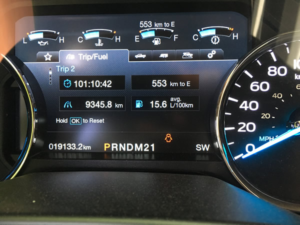
Friday morning, day 15. No sleep, really. After catching a couple of hours of shut eye in the truck at Funk's Grove Rest Area on I-55, we drove north up to the I-80 just east of Joliet, IL starting at about 2:30am, and then rolled east, under Chicago again, over to the same route through Michigan that we'd taken to get out west. We stopped for a McD's breakfast and gas in Bridgman, MI where the folks at the BP station were all talking about a car show they were headed to - nice rides getting some feul - 68 GTO, 65 Impala, 70 Gran Torino... the good news was the sqeegies were all working well and so the bugs were erased from the windows in short order. From there we got to the border; despite a long line to get over the Blue Water Bridge, the gent at the booth was pleasant and we sailed through. Canada, again, almost home. But, where is the coffee shop to have a pit stop? Nowhere. That's another Murphy, or maybe just a southwestern Ontario thing, but there is nowhere along the road from Sarnia to London to have a bio break if you need one. Dumb. We stopped at an On Route past London for a break. Then 403 > QEW > Lakehore > Woodbine and home. 9,346 kilometers (5,807 miles) in 15 days (101 hours of driving).
And I'd do it all again tomorrow.